**Nuwara Eliya**
-**Nuwara Eliya-** is located in Sri Lanka's Central Province's hill country.Its name means "city on the plain (table land)" or "city of light". The city, which has a beautiful scenery and a cool climate, serves as the administrative center of the Nuwara Eliya District. At 1,868 meters (6,128 feet) above sea level, it is regarded as Sri Lanka's most significant tea-producing site. The tallest peak in Sri Lanka, Pidurutalagala , towers over the city. It is well known that Nuwara Eliya has the coolest climate in all of Sri Lanka.
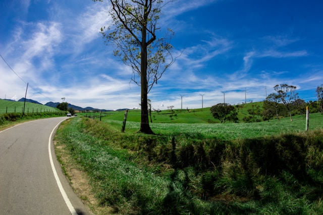
-**The distance between Colombo and Nuwara Eliya is approximately 170 kilometers (about 105 miles). Depending on traffic and the mode of transport, it can take 5 to 7 hours to travel between the two cities.The six to seven-hour trip from Colombo to Nuwara Eliya offers beautiful scenery. The train ride from Colombo to Nuwara Eliya offers scenic views and takes approximately 6 to 7 hours. A taxi ride directly from Colombo to Nuwara Eliya usually takes about 5 hours.
**History**
-**Samuel Baker-** the explorer of Lake Albert and the upper Nile, founded the settlement in 1846. The weather of Nuwara Eliya made it an ideal haven for British planters and civil servants in Ceylon. Little England, also known as Nuwara Eliya, was a hill country getaway where British colonialists could indulge in their favorite sports, including cricket, polo, golf, and deer, fox, and elephant hunting . Many of the structures, including the Queen's Cottage, General's House, Grand Hotel, Hill Club, St. Andrew's Hotel, and Town Post Office, still have elements from the colonial era. Colonial-style architecture and design are common in newly constructed hotels.Visitors to the city can wallow in its nostalgia of bygone days by visiting the landmark buildings. Many private homes maintain their old English-style lawns and gardens..
**Climate**
-**Nuwara Eliya-** boasts a temperate, cool climate, making it the coolest area in Sri Lanka. Due to its highland location, the city experiences a subtropical highland climate. Winter months may even bring frost at night, but the days warm up rapidly due to the high sun angle. annual temperature of 16 °C (61 °F).
**Gregory Lake**
-**A beautiful area for water sports and recreational activities, including speed boats, swan boats, and pony rides. Lake Gregory, commonly known as Gregory Lake or Gregory Reservoir, is a reservoir located in the center of Sri Lanka's hill town of Nuwara Eliya, which is known for its tea industry. In 1873, under the reign of British Governor Sir William Gregory, Lake Gregory was formed. The lake and the surrounding area make up the Gregory Lake Area .
**Victoria Park**
-**Victoria Park-** is a public park located in Nuwara Eliya, next to the Nuwara Eliya Post Office in Sri Lanka. In 1897, the park was formally named in honor of Queen Victoria's Diamond Jubilee. A visiting German princess planted the park's first tree, an oak, marking the park's official founding. A small children's playground and a miniature ridable railway may be found at the far end of the park .
**Bale Bazaar**
-**The Bale Bazaar-** in Nuwara Eliya is aptly nicknamed the BRANDED Winter Market because they sell WORLD FAMOUS BRANDED winter clothes for the cold Nuwara Eliya weather
**Strawberry Fields**
-**Strawberry Farms-** can be reached via Hakgala, Ambewela Road, New Zealand Farm Road. Freshly picked Strawberries are available at many outlets and cafes that serve Strawberry drinks, Ice cream pancakes etc. and very moderating priced. Grown at Ambewela Farm. Adam Agro, Rose Garden and many other farms located in Nuwara Eliya.
 |
| Photo by Lukas |
**Hakgala Botanical Garden**
-**Hakgala Botanical Garden-** is one of the five botanical gardens in Sri Lanka. The other four are Peradeniya Botanical Garden, Henarathgoda Botanical Garden, Mirijjawila Botanical Garden and Seetawaka Botanical Garden. Sri Lanka's second-biggest botanical garden.
-**Hakgala Botanical Garden is situated on the Nuwara Eliya-Badulla main road, 16 km from Nuwara Eliya and extents for about 28 hectares. The garden is located 5,400 feet above sea level, giving it a cool temperate climate. Over the course of a year, the mean annual temperature varies from 16 to 30 degrees Celsius. It experiences a cold environment from December to February and a warm climate from April to August.
**Ambewela Farm**
-**This farm is a few kilometers away from Nuwara Eliya in Ambewela. Both the Ambewela Farm and the New Zealand Farm are dairy farms. The distance between Ambewela Farm and New Zealand Farm is about 3–4 km. A farm in New Zealand raises Friesian cows that are purebred and preserves a pure cattle line. The cows are fed a rich diet and given sterilised water to ensure the quality of their milk is maintained. Superior medical treatment is provided around-the-clock. In addition to being a part of the Ambewela farm, which produces dairy products including milk, cheese, and yoghurt, one can view the largest grasslands in Sri Lanka here.
 |
| Photo by Lucie |
**Moon Plains**
-**Moon Plains-** is essentially a large plain surrounded by mountains, tea estates, and forest reserves with lush green grass. This is one among the spots to visit in Nuwara Eliya, with a wonderful view, and a nice place to unwind after a long day of touring. Once they arrive here, visitors can unwind, take in the fresh air, and feel joyful. It restores the simplicity lost in the intricate lives of city dwellers. It is among the most well-liked sights in Nuwara Eliya.
**Seetha Amman Kovil**
-**Seetha Amman Temple, or Seetha Eliya Seethai Amman Thirukkovil, also known as Ashok Vatika Sita Temple, is an ancient Vaishnavite Hindu temple located in the Nuwara Eliya District of Central Sri Lanka. Folklore at the temple has strong ties to the Hindu epic Ramayana. The mythology states that Sita was taken to this place by King Ravana of Lanka after she was captured. To exact revenge for Rama and Lakshmana's disdain for his sister Shurpanakha, Ravana set out to exact revenge. Sita Eliya Sita Temple is located 8 km southeast of the main town of Nuwara Eliya, along the Peradeniya-Badulla-Chenkaladi Highway. Hakgala Botanical Garden is located about 1.7 km southeast of the temple and is thought to be the garden that Ravana made for Sita in the Ramayana.
**Ramboda Falls**
-**Ramboda Falls-** is one of the most magnificent of the hundreds of beautiful waterfalls in Sri Lanka. It is located close to Nuwara Eliya in the lush hills. This waterfall and the surrounding amazing surroundings attract tourists. Ramboda Falls is 109 m (358 ft) high and the eleventh tallest waterfall in Sri Lanka and the 729th tallest waterfall in the world. It is located near Pussellawa, at Ramboda Pass on the A5. The Panna Oya, a tributary of the Kothmale Oya, forms the waterfall. The height of the falls is 945 meters (3,100 feet) above sea level.
 |
| author: A.Savin, Wikipedia |
**St. Clair’s Falls**
-**Nestled amidst the lush hills of Sri Lanka, St. Clair’s Falls stands as one of the widest waterfalls on the island. Its captivating beauty has earned it the nickname “The Little Niagara of Sri Lanka.” It is one of six waterfalls affected by the Upper Kotmale Hydropower Project. The falls are situated 3 kilometres (1.9 mi) west of the town of Talawakele on the Hatton-Talawakele Highway in Nuwara Eliya District. This waterfall is located in Kotmale Oya, a tributary of the Mahaweli River. The waterfall is named because it flows into a large pool that runs through a tea garden. The falls consist of two falls called "Maha Ella", which is 80 meters (260 ft) high and 50 meters (160 ft) wide, and "Kuda Ella" . which is 50 meters (160 ft) high and lies immediately below the main falls. St. Clair Falls is the 20th highest waterfall in Sri Lanka.
**Devon Falls**
-**Devon Falls-** also known as the 'Valley of the Valley', is a waterfall in Sri Lanka located 6 km (3.7 mi) west of Talawakele, Nuwara Eliya District on the A7 highway. The waterfall is named after Devon, an English coffee planter whose plantation was located nearby. This natural wonder attracts visitors with its beauty. Standing at an impressive height of 97 meters (318 ft), Devon Falls ranks as the 19th highest waterfall in the country. It is formed by a tributary of Kothmale Oya. It flows into the Mahaweli River. Devon Falls is 1,140 meters (3,740 ft) above sea level.
.jpg) |
| Author Rehman Abubakr |
**Laxapana Falls**
-**Laxapana Falls-** is at 126 m (413 ft) high, the 8th highest waterfall in Sri Lanka and the 625th highest in the world. It is situated in Maskeliya area in Nuwara Eliya District, about 16 km (9.9 mi) from Maskeliya town on Maskeliya-Norton Bridge road, in a village called Kiriwan Eliya. This is a waterfall formed by Maskeliya Oya, a tributary of the Kelani River. The falls derive their name from Sinhala words, "Laxa" meaning "Hundred thousand" and "Pahana" or "Pashana" meaning "rock". Lakshapana Falls is not only a natural wonder but also plays an important role in Sri Lanka's energy production. It supplies water for twin hydroelectric plants. The old Lakshapana plant producing 50 MW of electricity and the new Lakshapana plant producing 100 MW.
-**Bomburu Ella-** also known as Perawella Falls, is a waterfall at Uva-Paranagama Divisional Secretariat of Sri Lanka. It is located near the border of Nuwara Eliya and Badulla districts, approximately 15 km from Welimada town. With a height of about 50 meters (164 feet) and a width of more than 20 meters (65 feet), it is Sri Lanka’s widest waterfall. The specialty of Bomburu Falls is that it combines about ten waterfalls to form a wide waterfall.
**Kudahagala**
-**Kudahagala-** also known as Agrabopat Hill, is the fourth-tallest mountain in Sri Lanka. It rises to an altitude of 2,320 meters (7,610 feet) above mean sea level. Situated in the Nuwara Eliya District, this mountain is popular among tourists for hiking through dense jungle. The wide view from the top of Kudahagala makes it a great place to relax and appreciate nature.
**Totapolakanda**
-**Totapolakanda-** (also Thotupola Kanda) is the third highest mountain in Sri Lanka, situated in Nuwara Eliya district, 2,357 m (7,733 ft) above mean sea level. The mountain is located within Horton Plains National Park. The trail to the top of the hill starts a few meters from the Pattipola entrance to the National Park. Horton has a cool and windy climate. It's amazing how small trees and grasses have adapted.
Totapolakanda has the meaning of ‘Landing Site’ in Sinhala language which related to a legend of Rama and Ravana. According to the legend, King of India, Rama and his beautiful wife Sita lived in exile in the jungle. Once Ravana kidnapped Rama’s wife Sita and escaped to Sri Lanka. On the way to Sri Lanka plane first landed in Totapolakanda which has the meaning of landing site.
 |
| Author Buddhika Mawella |
**Pidurutalagala**
-**Pidurutalagala-** or previously Mount Pedro in English, is the highest mountain in Sri Lanka, at 2,524 m (8,281 ft). It is situated North-North-East from the town of Nuwara Eliya and is easily visible from most areas of the Central Province. The summit of Pidurutalagala is home to the central communications array of the Government of Sri Lanka and the armed forces, serving as an important point in the country’s radar system. Due to its strategic significance, the peak is currently designated as an “ultra-high security zone” and is protected by a large military base, making it strictly off-limits to the general public.


.jpg)
.jpg)
